Irvine, CA: Onsite Testing of the New DJI Phantom 4-RTK Drone & Propeller AeroPoints
We were onsite in Irvine to test out the new DJI Phantom 4-RTK drone and RTK base station. This was truly a collaboration: Site access from the customer, drone borrowed from one partner, Propeller Aeropoints from another partner and services from our team at Sky Ladder Drones. Also, the site already has fixed ground control points (GCPs.)
We flew multiple test flights — including having the DJI base station RTK on and RTK off. Also, we flew both our DJI Phantom 4 Pro and Phantom 4 Pro v2 drones.
Also, thanks to our friends at Propeller — they are processing one flight with their new PPK Processing. If we can get results with similar accuracy as using the bulky and cumbersome DJI RTK base station with only a single Propeller Aeropoint, it could significantly streamline our client’s capture workflow. Also the GCPs are difficult to maintain on a active work site — so eliminating (or minimizing) the GCPs would also save a lot of time and money. The customer is doing cut/fill analysis on the site to measure the amount of dirt movement completed, and what is still required. So accuracy is critically important.
We’ll keep you informed as the results come in…
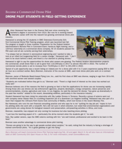
Setup with the Phantom 4-RTK & DJI D-RTK 2 Mobile Station (aka “Base Station”)
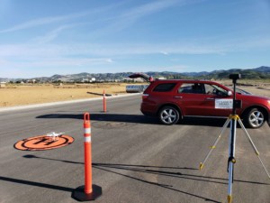
Close-up of DJI D-RTK 2 Mobile Station in field
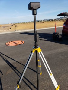
Propeller AeroPoint placed over a known point (for testing of Propeller’s new PPK Processing) – 10 AeroPoints were placed strategically for GCP/checkpoints.
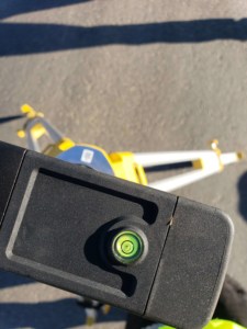
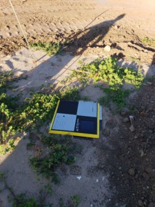
Level on the DJI D-RTK 2 Mobile Station (I thought it would be a cool photo to share)
.