Weekly Drone Mapping of Madrona Marsh Captures First Rainstorm of 2019/2020 Season

This week was the first rain of the 2019/2020 winter season here in the Los Angeles area — and we spent a couple hours documenting how the 43 acre Madrona Marsh has “come to life.”

As a longtime volunteer at the Madrona Marsh and Preserve, we’ve been documenting the seasons at the Marsh for the last year. Our mapping has allowed the Marsh management team to track water levels, vegetation growth, and serving as an overall management tool.

Our mapping capture of 399 images on Saturday, November 30, 2019, shows how 1.08 inches of rain immediately changes the Marsh with both water and wildlife. See a “Before/After” map of this first season rain here:

https://www.skyladderdrones.com/projects/2d-mapping-nov-example-madrona-marsh

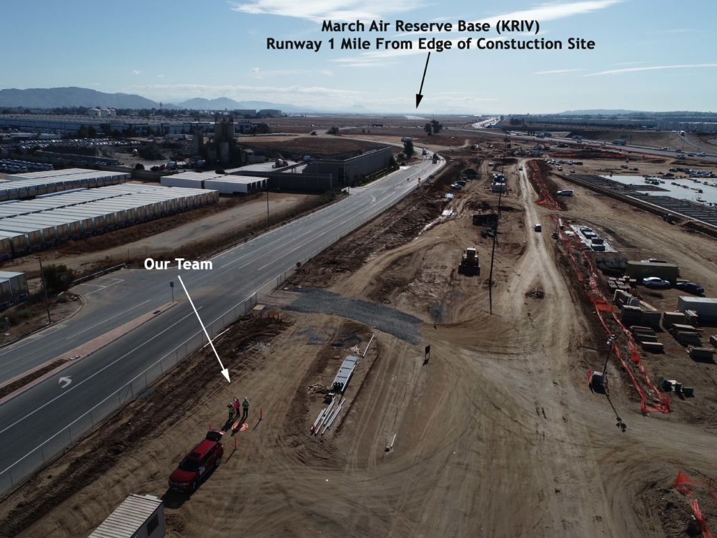
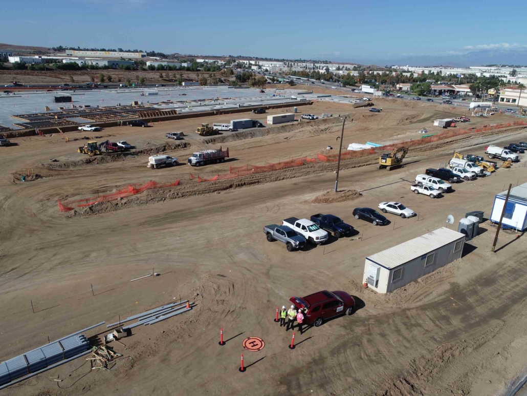
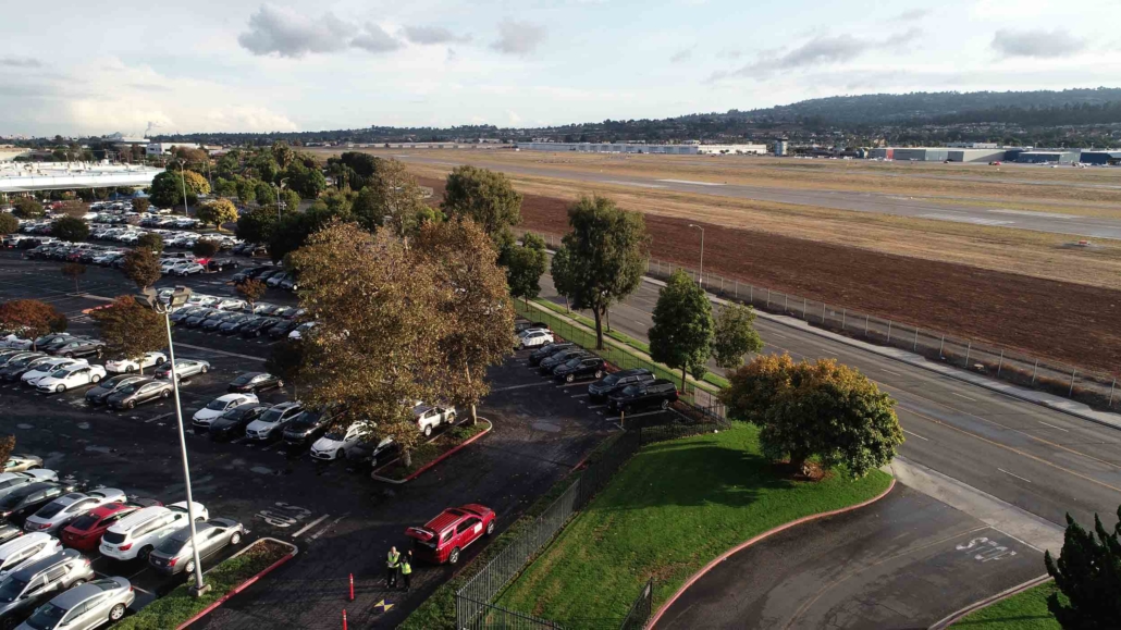
***A special thank you to Torrance Airport Air Traffic Control for working with us to approve weekly airspace authorizations in what is designated as a “No Fly Zone.” These flights have enabled us to provide this resource to the Torrance city-owned Madrona Marsh and Preserve.

Successful Flights in March Air Reserve Base “Zero Grid” to Capture New Construction Progress

I had a great morning with Desiree and Mariel capturing a construction progress job. Besides being a beautiful day, it was really cool flying near March ARB with “real-time deconfliction” coordination with their air traffic control. But, when you get a call from ATC to advise you that there will be UAV activity we need to avoid — you don’t expect a huge Reaper UAV doing touch-and-goes nearby. (at least I think it is a Reaper from the attached picture Desi took.) #zerogrid #ATC-Called-US!

1 mile from March ARB – with “real-time deconfliction”

Our team Onsite (and yes, that is Desi in a pink safety vest!)

We finished just as the Reaper UAV began flying training missions nearby.

Mapping Mission Adjacent to Torrance Airport

We recently got a call from a property owner who wanted a precision map of their property. After learning about their needs, the first question we asked was — what is the address of your property so we can confirm it is someplace we can safely fly. When the owner shared that the site was just across the street from Torrance Airport (Class D airspace) we immediately shared that his property’s location might be an issue… but that we’d try to get authorization.

We regularly fly in what is considered “zero grid” or “do not fly” airspace, but this was the closest to Torrance Airport we would had ever flown. So, after reviewing flight patterns and the heights of surrounding buildings, we submitted a request to the airport for our 1 hour flight. We included mitigation to fly lower that usual — but which would avoid any possible conflicts with aircraft. We also shared that we would monitor the airport’s traffic on a special airport traffic frequency radio to ensure a safe mission.

We received permission to fly a few days after submitting our request and we took this “selfie” of intern Mariel and pilot Steven just to document the historic (and safe) event.


Mariel and Steven all setup in a parking lot adjacent to Torrance Airport.

Sky Ladder Drones Supports the FAA’s National Drone Safety Week at Redondo Union High School

Partners WH4, Flying Lion and Sky Ladder Drones supported the FAA’s National Drone Safety Week with a demonstration/presentation during lunch at Redondo Union High School. #DroneWeek #FAANationalDroneSafetyWeek Sky Ladder Drones


Some stickers we handed out.


Barry Brennan of Flying Lion being interviewed by RUHS student TV.