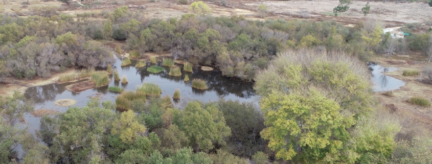
Weekly Drone Mapping of Madrona Marsh Captures First Rainstorm of 2019/2020 Season
This week was the first rain of the 2019/2020 winter season here in the Los Angeles area — and we spent a couple hours documenting how the 43 acre Madrona Marsh has “come to life.”
As a longtime volunteer at the Madrona Marsh and Preserve, we’ve been documenting the seasons at the Marsh for the last year. Our mapping has allowed the Marsh management team to track water levels, vegetation growth, and serving as an overall management tool.
Our mapping capture of 399 images on Saturday, November 30, 2019, shows how 1.08 inches of rain immediately changes the Marsh with both water and wildlife. See a “Before/After” map of this first season rain here:
https://www.skyladderdrones.com/projects/2d-mapping-nov-example-madrona-marsh
***A special thank you to Torrance Airport Air Traffic Control for working with us to approve weekly airspace authorizations in what is designated as a “No Fly Zone.” These flights have enabled us to provide this resource to the Torrance city-owned Madrona Marsh and Preserve.


